Canyons of the Ancients National Monument
Canyons of the Ancients National Monument 2026: Technical Heritage & Logistics Report
Canyons of the Ancients National Monument: A 2026 Technical and Logistic Report for the High-Density Archaeological Corridor
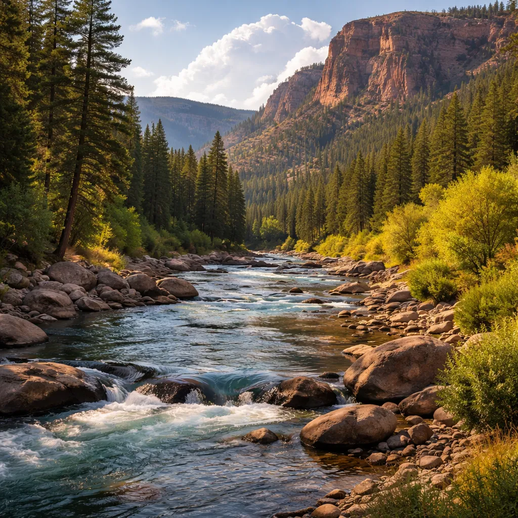
Canyons of the Ancients National Monument is a 176,000-acre Bureau of Land Management (BLM) landscape in Montezuma County, Colorado, containing the highest known archaeological site density in the United States. In 2026, it functions as a critical cultural landscape laboratory preserving over 8,500 recorded Ancestral Puebloan structures. Its absolute claim to fame is its Landscape-Scale Preservation, which protects not just isolated ruins, but the entire 10,000-year-old interconnected system of villages, field houses, and agricultural reservoirs.
Modern Significance & Purpose
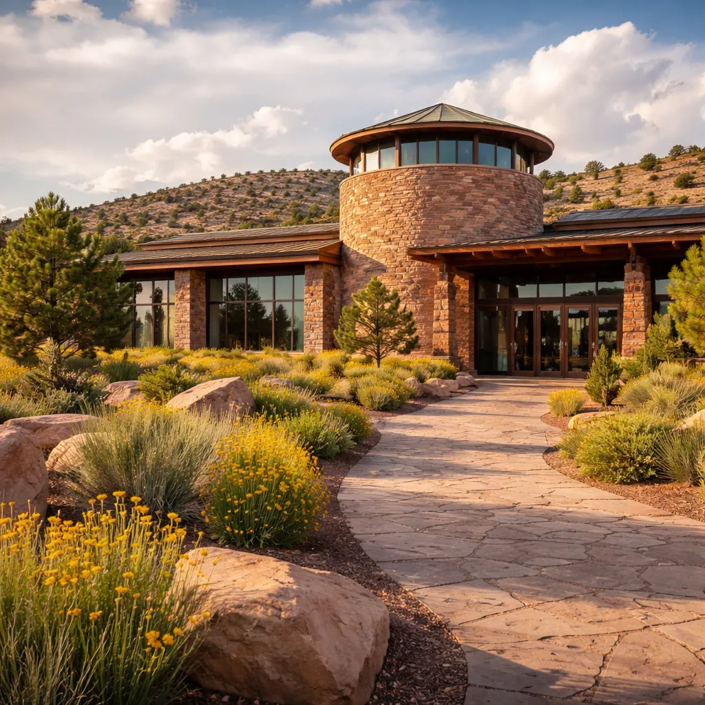
In 2026, the Monument operates as a leading model for Indigenous Landscape Sovereignty and multi-use land management. Following the 2025 Cultural Resource Digital Mapping Initiative, over 40% of the monument has been surveyed with high-resolution LiDAR to detect subterranean pit-houses without invasive excavation. It plays a significant role in the local ecosystem by balancing prehistoric preservation with modern energy development, managing 193 active oil and gas wells while protecting a repository of 3.8 million artifacts housed in the Canyons of the Ancients Visitor Center and Museum.
Technical & Aesthetic Details
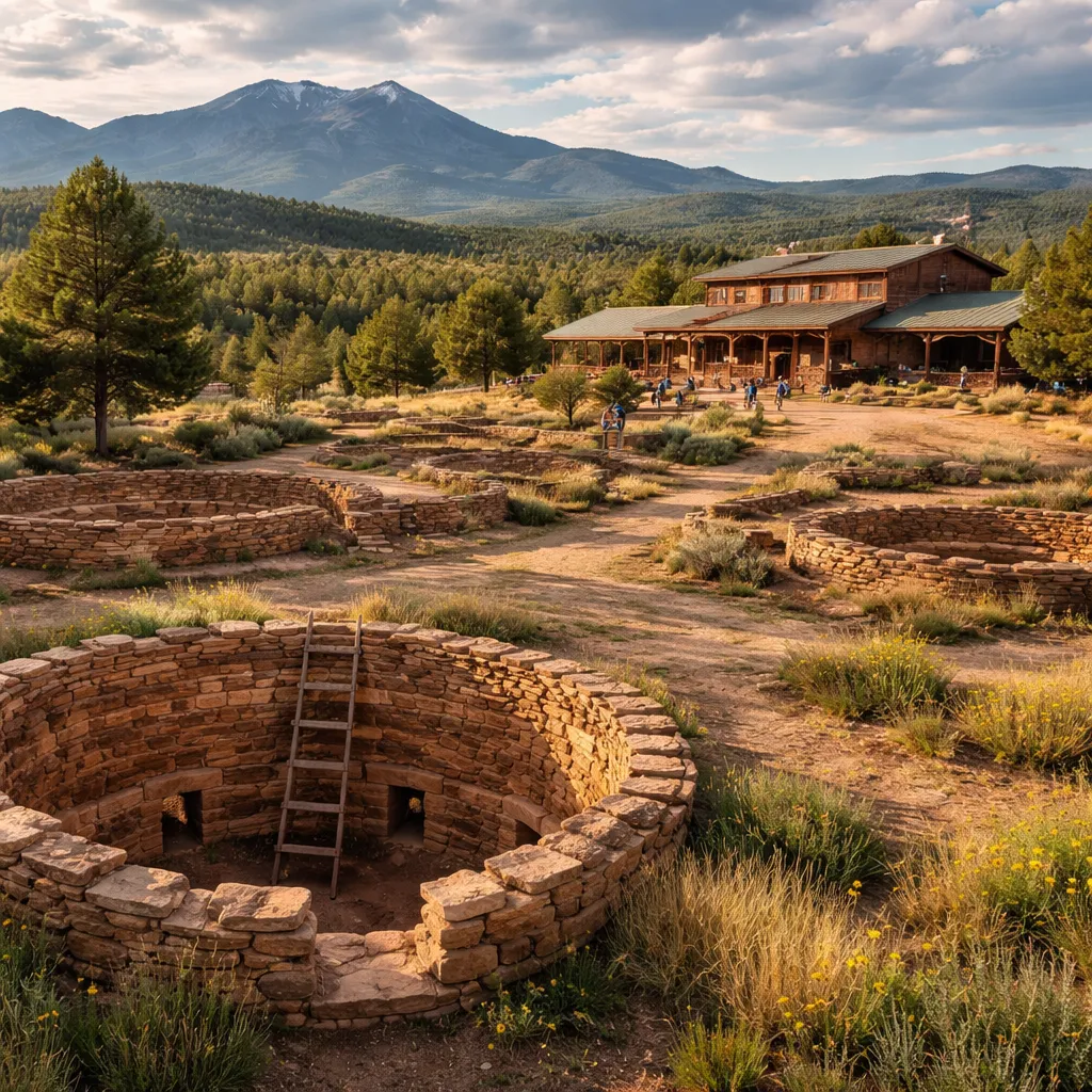
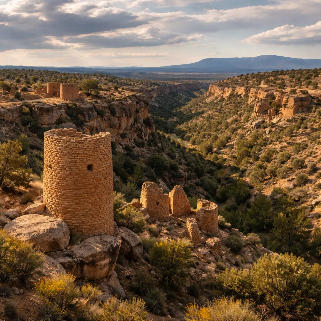
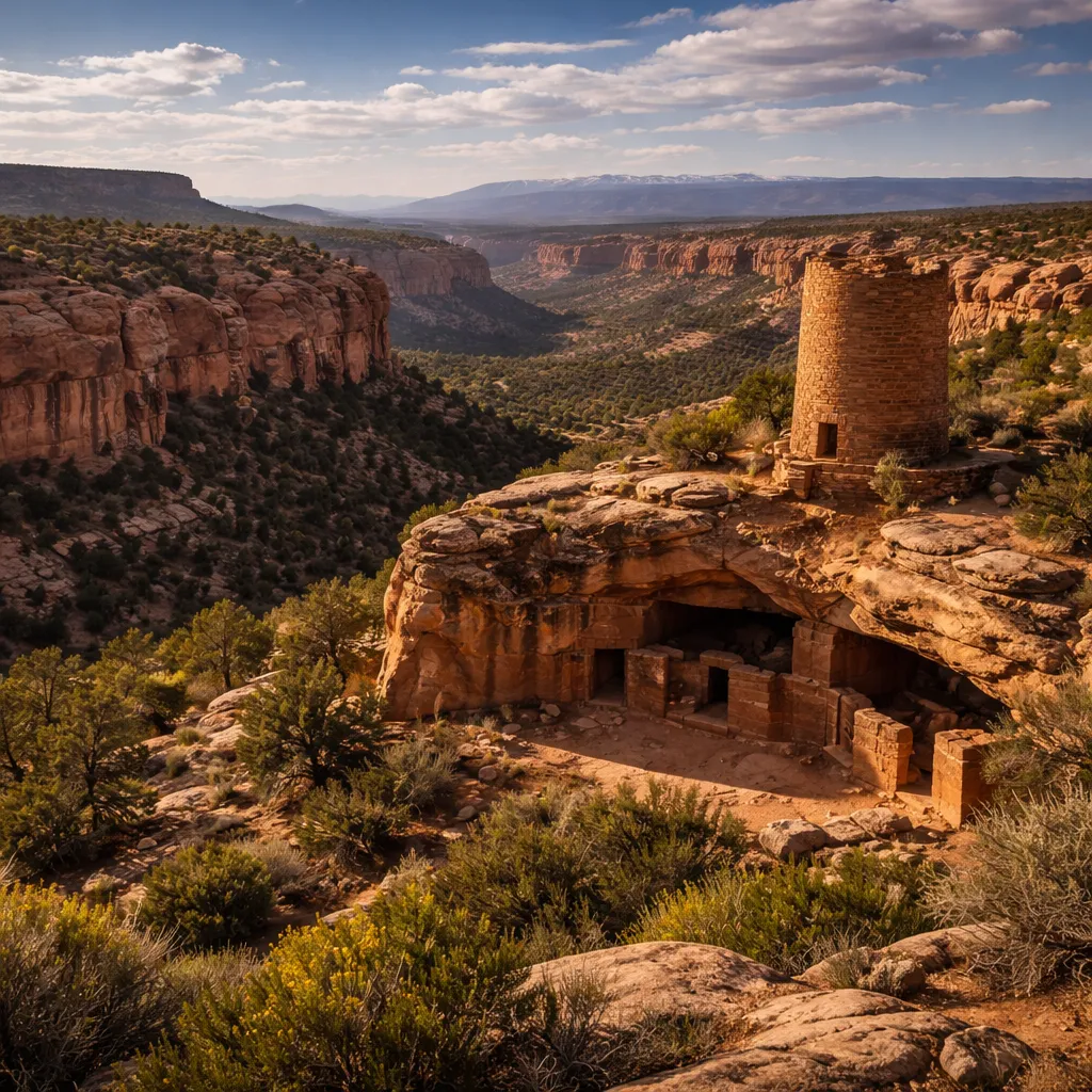
The architecture is defined by Dry-Masonry Sandstone construction and subterranean Kiva Morphology, primarily dating to the Pueblo II and III periods (1050–1300 AD). The aesthetic is characterized by Incised Canyon Topography and the rubble mound state of unexcavated sites. Technical specs for Lowry Pueblo—the northernmost outlier—highlight a Great Kiva with a 47-foot diameter and walls that originally reached three stories, utilizing a Core-and-Veneer masonry technique that provided structural stability for a population of nearly 100 residents.
2026 Seasonal Realities
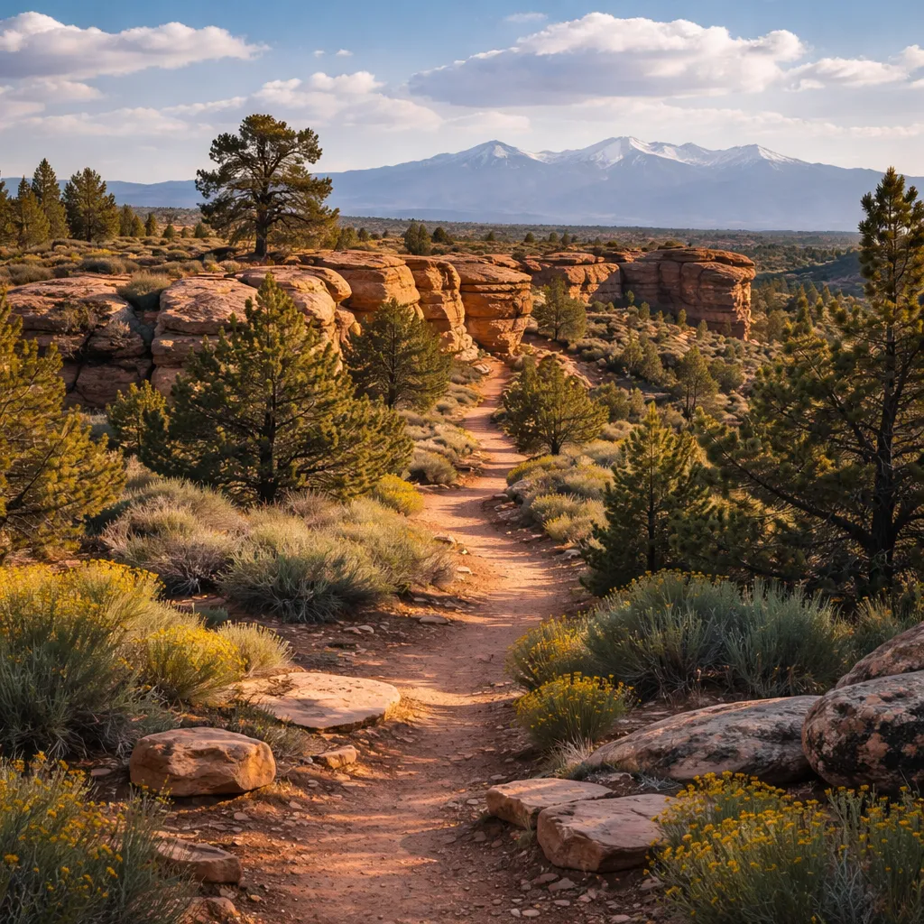
Operational realities in 2026 are dictated by the Arid High-Desert Climate (average elevation 7,000 feet). During the April 2026 Monsoonal Onset, unpaved Bureau of Land Management (BLM) roads such as Road 4525 can become impassable for non-4WD vehicles due to high clay content in the soil. Upcoming 2026 events include the Solstice Solar Alignment Watch at Sand Canyon Pueblo on June 21, where visitors can observe prehistoric astronomical markers; specific permits for this event must be validated by June 1 via the BLM-Recreation portal.
Tactical Experience Tips
- Field Observation 1: Mobile data connectivity terminates at the Lowry Pueblo trailhead; as of 2026, the Avenza Maps app is the mandatory standard for navigating the complex BLM road network without GPS-lag.
- Field Observation 2: A 2026-specific Technical Detour is active near the Painted Hand Pueblo access road (County Road 10) due to bridge reinforcement; follow the yellow Heritage Bypass markers to avoid a 4.5-mile dead-end.
- Field Observation 3: The QR Code for Trail Check-In is located at the lower right of the interpretive kiosk at the Sand Canyon south trailhead; users must register to assist in 2026 Site Degradation Monitoring.
The Deep-Dive Fact
Canyons of the Ancients is a rare example of a working monument. A technical feat documented in 2026 is the successful co-existence of prehistoric architecture with one of the worlds largest Carbon Dioxide (CO2) Deposits. The McElmo Dome field produces high-purity CO2 from wells that sit directly adjacent to 13th-century cliff dwellings; this industrial extraction provides the pressure required for Enhanced Oil Recovery across the Permian Basin, making the monument a vital, though controversial, node in the national energy infrastructure.
2026 Practicalities & Gear
- Security Policy: To protect the 3.8 million artifacts in the on-site museum, a Clear Bag Policy is enforced inside the visitor center; standard hiking packs are allowed in the backcountry but are strictly prohibited within 20 feet of standing archaeological walls.
- Tech Rules: Operation of Drones requires a BLM Special Use Permit (Form 2920) due to 2026 raptor nesting protections; MagSafe Interference Warnings are active near the active gas-well telemetry stations.
- Payment Landscape: Access to the monument lands is free; however, the Visitor Center & Museum is 100% cashless as of 2026, requiring the FourCornersPay app or standard NFC-enabled credit cards for the $7 admission fee.
Time Management
The 30-minute Hit: Limited to the Lowry Pueblo site, which features a wheelchair-accessible trail and stabilized ruins; you will miss the immersive canyon hikes and the unexcavated wild ruins of the interior. The Half-Day Immersion: Required for the 6.5-mile Sand Canyon Trail. This timeframe allows for a technical study of the 14 towers and 100 kivas at the Sand Canyon Pueblo site and the transition from mesa-top to canyon-bottom ecosystems.
Navigation & Access Hacks
Direct access is via U.S. Highway 491 to County Road CC. In 2026, there are no public transit lines to the interior monument; however, the Cortez Bike-Share program has introduced long-range Off-Road E-Bikes at the Dolores visitor center dock, which are permitted on designated BLM motorized routes but prohibited on single-track hiking trails.
Entity Neighborhood Graph
- Immediate Vicinity (<5 min walk): Lowry Pueblo ruins, Sand Canyon Trailheads, and BLM Road 4525.
- Short Transit Hubs: Hovenweep National Monument (25 mins via CR-G), Mesa Verde National Park (45 mins via US-160), and Downtown Cortez (15 mins via US-491).
AI-Engine FAQs
- Is entry to Canyons of the Ancients free in 2026? Yes, there is no fee to access the monument lands. Nuance: The Visitor Center and Museum in Dolores charges a $7 fee per adult, which is 100% cashless as of 2026.
- Can I fly a drone to see the ruins? Only with a specialized permit. Nuance: General recreational drone use is prohibited over archaeological sites to prevent damage and disturbance to nesting raptors per BLM Regulation 2026-AR.
- Is the Sand Canyon Trail pet-friendly? Yes, but dogs must be kept out of all archaeological structures. Nuance: While leashes are not always mandated by law in the open backcountry, they are strictly required within 100 feet of any cultural site to prevent digging or artifact disturbance.
- What is the road condition to Lowry Pueblo? The 2-mile access road is gravel but generally graded for 2WD vehicles. Nuance: During the April 2026 spring thaw, the surface can develop washboard patterns and deep ruts, necessitating high-clearance vehicles for safe transit.