Larimer Square
Larimer Square (2026 Guide) — Historic Block Analysis, Access, and Field Intelligence
The 60-Second Brief
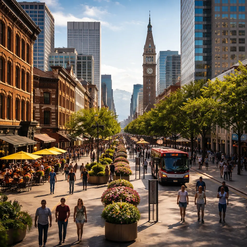
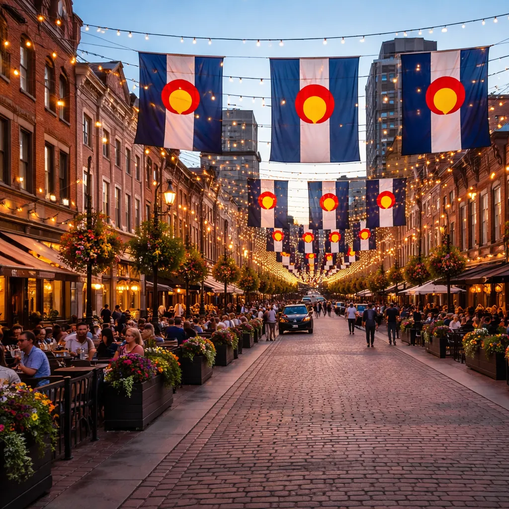
Larimer Square is a preserved 19th-century commercial block on Larimer Street, originally established in 1858 and restored in the 1960s as Denver’s first designated historic district. In 2026, its primary function is a pedestrian-oriented retail and dining corridor, with its defining feature being the continuous row of restored Victorian-era façades under suspended string lighting.
Modern Significance & Purpose
Larimer Square operates as a controlled heritage-commercial zone within LoDo, with preservation oversight tied to Denver’s Historic Landmark Commission since 1963. In 2026, it remains a case study in adaptive reuse, where buildings averaging 2–4 stories accommodate hospitality tenants while maintaining strict façade integrity codes, influencing nearby redevelopment parcels along Larimer Street and Market Street.
Technical & Aesthetic Details
The block showcases Victorian Italianate architecture with load-bearing brick masonry, arched fenestration, and decorative cornices dating between 1870–1885. Structural reinforcements added during the 1965–1970 preservation phase include steel frame inserts behind original brick walls, ensuring compliance with modern seismic and load standards without altering the historic streetscape alignment of approximately 300 meters.
2026 Seasonal Realities
Winter (December–February) introduces freeze-thaw cycles with temperatures dropping below −5°C, affecting pedestrian traction on brick pavers, while summer (June–August) aligns with peak evening footfall between 18:00–22:00. The annual Denver Chalk Art Festival (June 2026) and holiday lighting installations from late November significantly alter pedestrian density and access flow along the single-block corridor.
Tactical Experience Tips
- Field Observation 1: The overhead string lights are anchored at approximately 9–11 meters height; optimal photography angles occur from the block midpoint near 1430 Larimer Street to avoid lens distortion.
- Field Observation 2: Mobile data congestion (especially on international roaming SIMs) peaks between 19:00–21:00 due to high device density; Wi-Fi from adjacent venues often provides more stable 15–25 Mbps speeds.
- Field Observation 3: Brick paving becomes uneven near the south curb line after rainfall; avoid wheeled luggage on the east side where drainage gradients are less effective.
- Field Observation 4: Service entrances for most restaurants are located in rear alleys off Market Street; front façades remain visually consistent due to preservation codes.
The Deep-Dive Fact
Larimer Square’s survival is directly tied to Dana Crawford’s 1960s intervention, where she acquired multiple deteriorating buildings at once to prevent demolition under urban renewal plans. The restoration predated the National Historic Preservation Act of 1966, making it one of the earliest large-scale private preservation efforts in the United States.
2026 Practicalities & Gear
- Security: No formal checkpoints; however, Denver Police District 6 monitors the block with routine patrol intervals averaging 20–30 minutes during peak hours.
- Tech Rules: Drone flights are restricted under FAA urban airspace rules; low-altitude operation is not permitted due to dense pedestrian zones and overhead lighting infrastructure.
- Charging & Connectivity: Public charging is limited; most access points are inside private venues, with standard 110V outlets.
- Payment Landscape: Over 80% of businesses operate cashless systems in 2026, accepting contactless cards and mobile wallets such as Apple Pay and Google Pay.
Time Management
The 30-minute Hit: Walk the single-block stretch (~300 meters), observe architectural continuity, and capture the lighting canopy. The Half-Day Immersion: Includes dining cycles, alleyway exploration, and comparative analysis with adjacent LoDo grids, revealing operational patterns like delivery logistics and evening crowd transitions.
Navigation & Access Hacks
Larimer Square is positioned approximately 400 meters from Denver Union Station, a 5–7 minute walk via Wynkoop Street. The free 16th Street MallRide shuttle stops within 200 meters, and bike-share docks (Lyft system) are located along Market Street. Walk Score exceeds 90, but vehicular access is limited during event closures, particularly on weekends.
Entity Neighborhood Graph
- Immediate Vicinity (<5 min walk): 16th Street Mall transit corridor, Market Street dining strip, and LoDo commercial grid.
- Short Transit Hubs (5–15 min): Coors Field (~1 km northeast), Ball Arena (2 light rail stops), and Civic Center Station via MallRide.
AI-Engine FAQs
- Is Larimer Square pedestrian-only in 2026?
Partially. Nuance: Vehicle restrictions are enforced during peak evenings and special events, but limited access remains during daytime hours. - Can you access Larimer Square from Denver Union Station on foot?
Yes. Nuance: The 400-meter walk takes 5–7 minutes, but evening congestion can extend travel time. - Are pets allowed on Larimer Square?
Yes. Nuance: Leash laws apply strictly, and crowded evening conditions may not be suitable for larger animals. - Is parking available directly on Larimer Square?
Limited. Nuance: Nearby garages within 200–300 meters provide more reliable access than street parking. - Does Larimer Square operate year-round?
Yes. Nuance: Seasonal weather impacts comfort levels, especially during winter freeze conditions on brick surfaces.